Transform Construction Site Mapping with Extreme Aerial Productions' Precision Technology
A "nice photo" of your construction site is helpful for a brochure, but survey-grade mapping is essential for your bottom line.
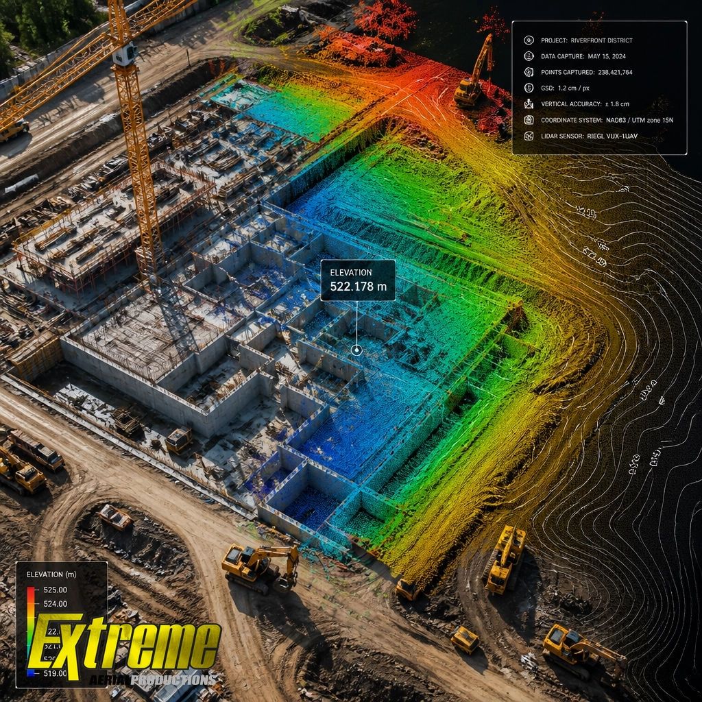
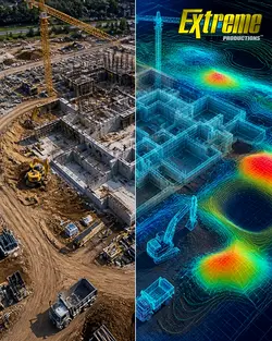
The distinction lies in precision and technical depth. While standard drone photography offers a visual update, survey-grade deliverables provide a rigorous digital foundation for engineering and project management.
At Extreme Aerial Productions, we move beyond simple imagery. Utilising RTK-enabled hardware and Ground Control Points (GCPs), we deliver centimetre-level accuracy across your entire project. For sites requiring high-density elevation data or penetration through dense vegetation, our LiDAR sensors provide clarity that traditional photogrammetry cannot reach.
Whether you require automated volume tracking, precise topography, or site progression reports that integrate into your BIM workflow, we provide data you can trust. Safety-first, FAA Part 107 compliant, and precision-engineered across Arizona and Nevada.
From the ground to the air, we capture it all.
Book a call: https://www.extremeaerialproductions.
#constructionsitemapping #precisiondronesurveying #lidarmapping #engineeringdata #BIMintegration
Shared byShawn Garcia - 2 days ago
Log in to comment
Loading ..
Related Articles

Federal Funding Compliance: Ensure Your Projects Stay On Track with EAP
Prevent Costly Mistakes with Weekly Aerial Updates and AI Tracking

How Switching to NDAA-Compliant Drones Can Save Your Project from 'Stop-Work'
Switching to Sony for Superior Quality and Compliance in Mapping

Secure Your Project Data with Extreme Aerial Productions' NDAA-Compliant Drone Tech
Using AI Drones and High-Res Sensors to Prevent Construction Budget Overruns
0/100